This module allows you to:
- Import a set of points from a CSV file.
- Annotate a set of points with given data.
- Show the values attached to a point.
- Erase annotations and points.
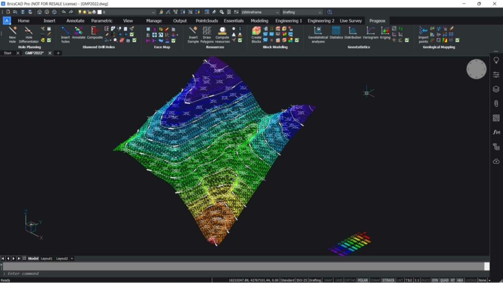
- Create an implicit model of a lithology
- Model a surface of a property
- Draw the contours from a set of points based on grade.
- Import a set of structures from a file.
- Join selected hatches into a single one.
- Join polyline surfaces into one or many new polyline surfaces.
- Create a bubble chart from selected GMP points
- Create lithology-assigned hatches.
- Colour GMP points using grade intervals or lithology from Promine Essentials.