Proviz – Point cloud Visualization
Get a web application to easily manage your point cloud data and integrate it with mining, surveying, and geology software.
At Promine, we understand that the mining and surveying industries are fast-evolving and need new solutions to tackle bigger challenges and time efficiency issues. Proviz aims to help engineers, geologists, and surveyors by closing the gap between obtaining accurate models and project design.
Proviz is a secure, robust web application that allows you to import point cloud data files digitally, store them, customize the point data, and export the final design to an industry standard format. These filetypes can be used in a variety of mining, surveying, or geology software, and are fully compatible with Promine.
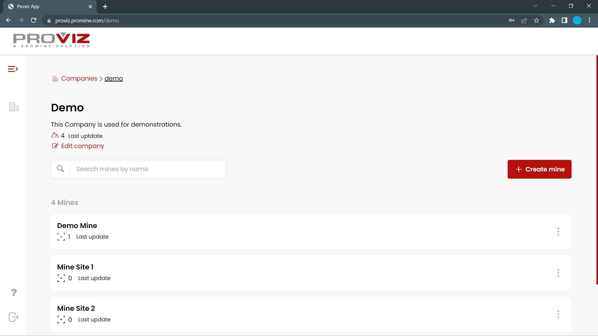
Stay organized by creating a list of different types of mine sites or projects to manage your point cloud data. The list is securely stored and can be accessed from anywhere around the world.
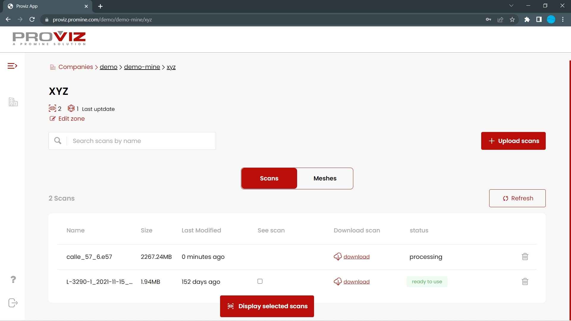
Upload and download scans easily from a secure cloud personalized for you. Our user-friendly interface, developed specifically for engineers, geologists, and surveyors, makes your life easier.
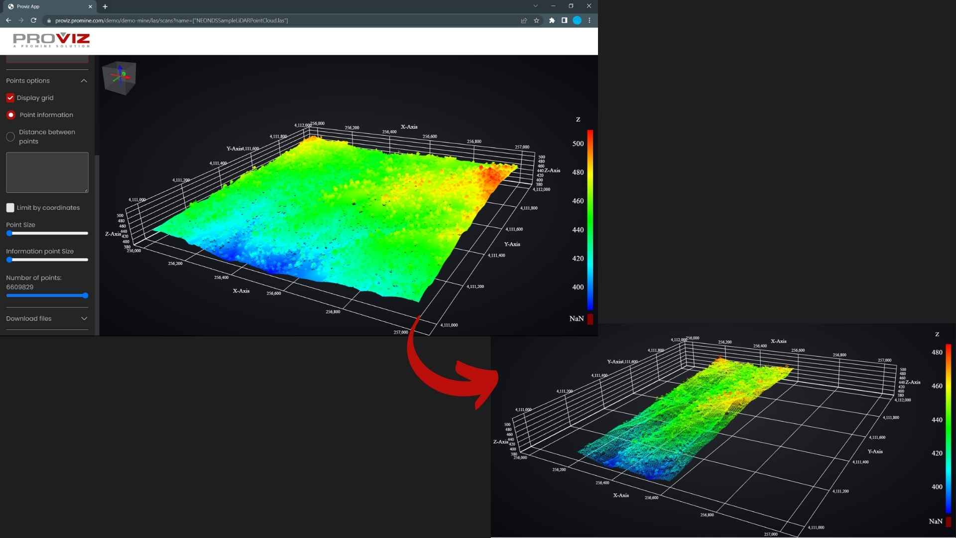
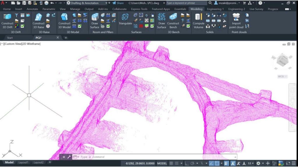
Visualize your point cloud in 3D instantly with confidence from anywhere around the world. For better visualization, reduce or increase the number of points, and limit the point cloud by coordinates. Export your final filtered point cloud file or simply the same original point cloud to another filetype.
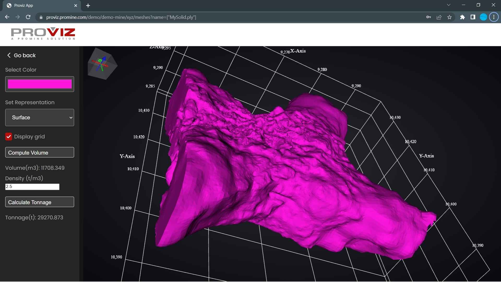
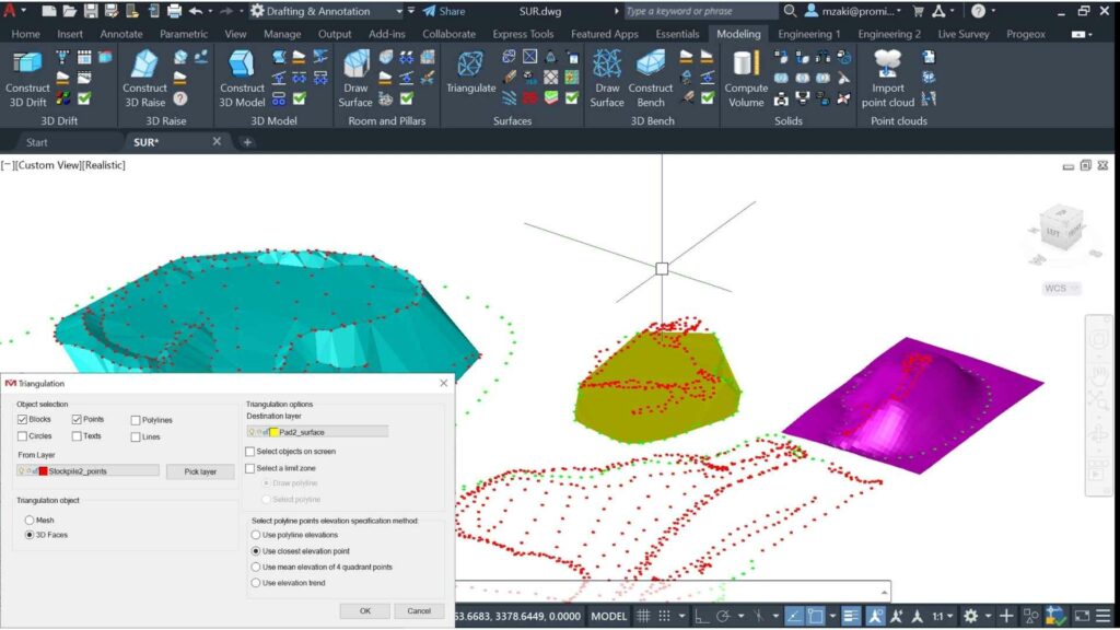
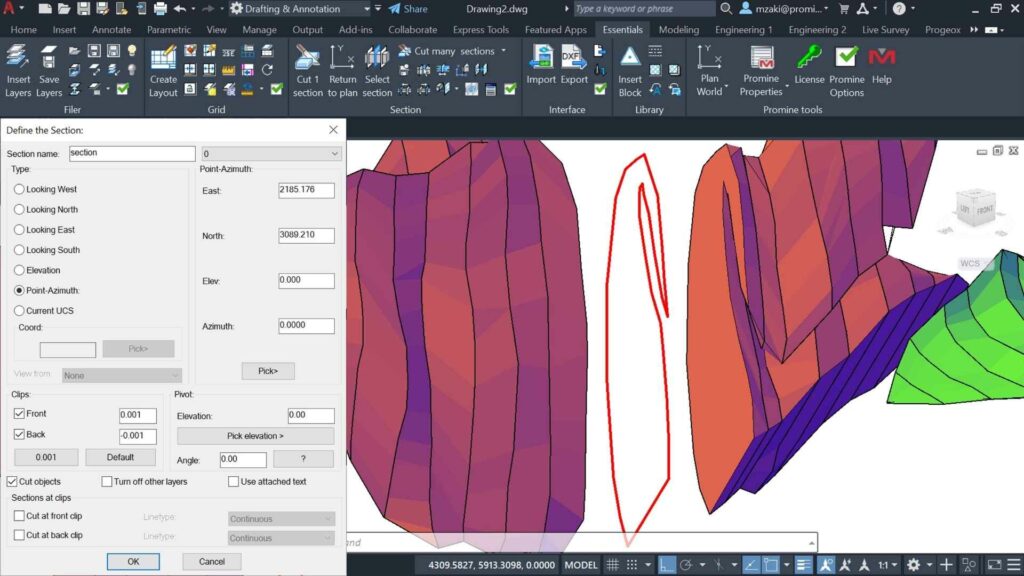
Extend your functionality by quickly generating a solid or a mesh compatible with AutoCAD or BricsCAD. Get volume and tonnage calculations through Proviz’s mesh visualizer, which is simplified for an easy to-use-experience.
Proviz is designed to make your life easier and to be able to import or export point cloud data files hassle-free. Point cloud data is much more accurate than traditional surveying; so, this allows you to validate asbuilt developments or project components against planning to ensure data integrity. This process will enable you to get accurate results, make better decisions, have more control over the cost and prevent project delays due to misinformation.
The final point data can be easily exported in PLY or DXF, making Proviz compatible with a wide variety of mining, surveying, and geology software. Proviz also can downsample your point cloud data file and limit points by coordinates, which results in a smaller file size. This is significantly useful for Autodesk users who need to limit the point cloud file to import in CAD platforms.
3D scanning devices, such as LIDAR or UAV, can capture an enormous number of points in a matter seconds, and with better accuracy compared to traditional surveying. Having a userfriendly platform to view this data accurately allows the engineer or surveyor to sit comfortably in their office and reduce the number of site visits; hence, saving a lot of time and being more efficient.
Save time by intelligently reducing the number of points of a large point cloud.
Create 3D models and sections from point clouds to get accurate volume calculations.
Triangulate and manipulate 3D surfaces by switching 3D faces, adding points, editing lines, and adding elevation contour lines using color coding. Create modelized, smooth surfaces for better visualization.
Promine’s most versatile module. Easily cut sections in any direction and elevation. Each section can then be viewed, modified, copied, moved and used in many other modules.
Discover all the features we have to offer you through our different licenses.
Proviz
Point Cloud Viewer
Support file size up to 0.5 GB
Mesh creation from point cloud
Proviz Silver
Support file size up to 10 GB
Support up to 10M points
Points reduction (Linear decimation)
Proviz Gold
Zone Definition
Volume Computation
Overbreak and Underbreak computation
System requirements for Proviz | ||
Processor | 2.5 GHz or more, multiple core supported. | |
Memory | 8GB, 16GB or more recommended. More memory = more points displayed and more fluidity. | |
Display Resolution | 1920×1080 or more. | |
Display Card | 1 GB or more, 4GB recommended. | |
Disk Space | 6.0 GB | |
Browser | Google Chrome recommended. Edge, Firefox and Safari can run the application. | |
.NET Framework | .NET Framework Version 4.7 or later *DirectX11 recommended by supported OS |
Supported Importation filetypes for Proviz | Supported Exportation filetypes for Proviz |
e57 | e57 |
LAS | LAS |
TXT | TXT |
PLY | PLY |
| DXF |
Fill the form below and a Promine representative will be in touch with you to answer all your inquiries and provide you with a trial license.
Proviz needs a point cloud data file of type e57, las, txt or ply. If you do not have one of these files and are interested in this product, you can still contact us for a live demonstration. A Promine representative will be glad to assist you.
Yes, clients benefit from exclusive Promine benefits. We understand that the mining industry is constantly changing and that every client may need different features. As a client, you can request additional customized software development.
This product is sold per user basis. The licensing and activation can be done online; there is no need for on-site setup. You may request a Promine representative to come on-site to perform the full activation; Otherwise, this can be done online.
Promine is a Business-to-Business solution for mining, surveying and geology Companies. For payments, please contact an account executive from the contact us page. The account executive will then proceed to send you a quote, which can be paid by a bank transfer or online using a credit card.
Yes, both are using the very common DXF format to exchange data. A seamless integration with the Filer module is in the making right now.
Yes. We can provide you with various data security levels. If you prefer, you can even host the data on your cloud servers, choosing yourself the desired level of security.