Promine Live Survey is a hardware-software solution to keep track of your drift developpment progress. The system is designed to be used by surveyors as well as miners to survey essential points of your development drifts and to give accurate directions and slopes to the miners. The data is displayed live as it is collected, enabling users to spot any discrepancies with the planned design.
The system uses a Leica instrument and a windows tablet with AutoCAD or BricsCAD. The process is entirely done within the software: resection, surveying walls, backs, floors, staking point, showing planned walls and slopes, surveying drill holes, etc. The survey data can be transmitted automatically when the tablet is back in its docking station or when it connects to you network.
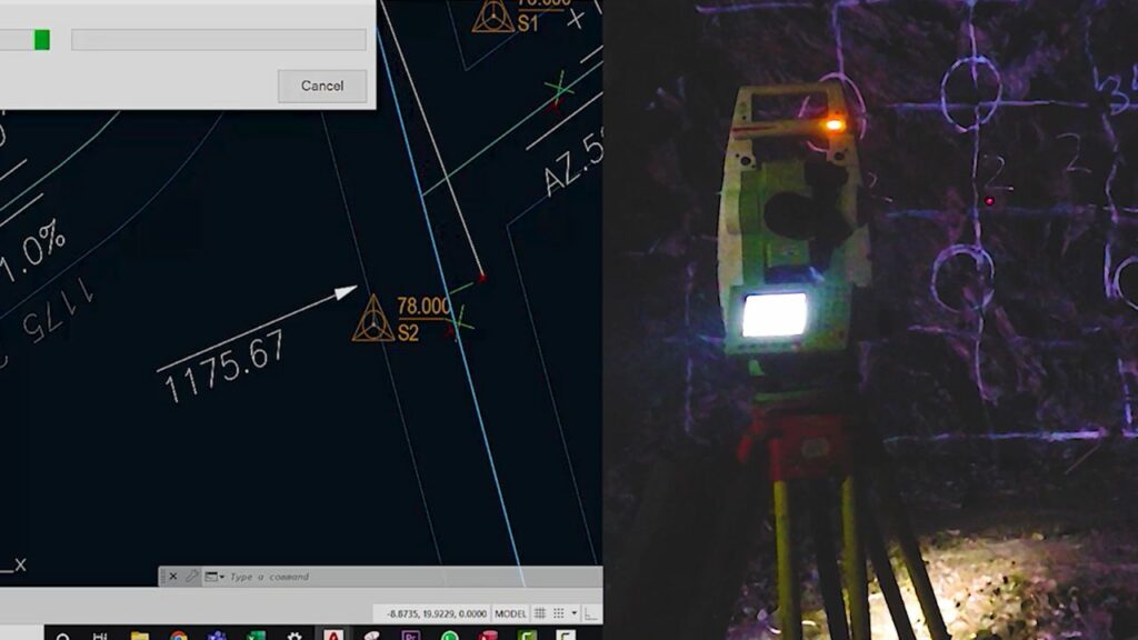
Make a resection, implant new survey stations and see them instantly in the drawing, store stations in a database of your choice, etc. All those can be done right at the face with tools adapted to the need of underground mining surveying.
You can accomplish this within a few minutes with a few commands: set up the instrument, follow instructions to make the resection and point the instrument toward the center of the face. That is all you need to have the instrument collect wall points.
Scan you drift contour to get a section view comparing the planned and actual profile. Get the computation of the overbreak and under break areas.
Let the instrument show you the design centerline, walls and the slope to follow. You are at an intersection? No problem, select which heading (s) you want to follow. Changes of slopes at ramp entry or exit? No problem, The slope is adjusted to the next round to be taken.
You need to implant a point at a given coordinate either on floor, wall or back? Let the program direct the laser pointer of the instrument to that exact point.
Mark the drilling direction according to the radius curve and the space available to the drill booms. The length of the drill hole on the inside of the curve is also computed according to the designed radius and current face profile to ensure that the face stays perpendicular to the direction of your development.
Related
During this webinar, you will learn about our Live Survey module, a new way to get survey data instantly.
7:00 PM GMT+3 Africa
12:00 PM ET Canada
10:00 AM PT Canada
9:00 AM PT Canada
August 22nd, 2023
Promine specialists provide worlwide service and will be happy to give you a free demo for you to know Promine better .
Terms of services & politics | © 2022 Promine inc. All Rights Reserved.